Sunday, December 20, 2015

Charity Fair Project Blog 12/20

INSERT TRI-FOLD PICTURE


Summary

This week, I participated in the second annual Adventure Charity Fair. The first and probably most important thing I learned about this project was that if you know you have a strict due date, WORK PROFICIENTLY and MANAGE YOUR TIME. I also learned what a carbon footprint was. For our tri-fold board, we had to calculate the carbon footprint of our product. A carbon footprint is the CO2 emissions produced when someone or something moves around or does something. 


Sunday, December 13, 2015

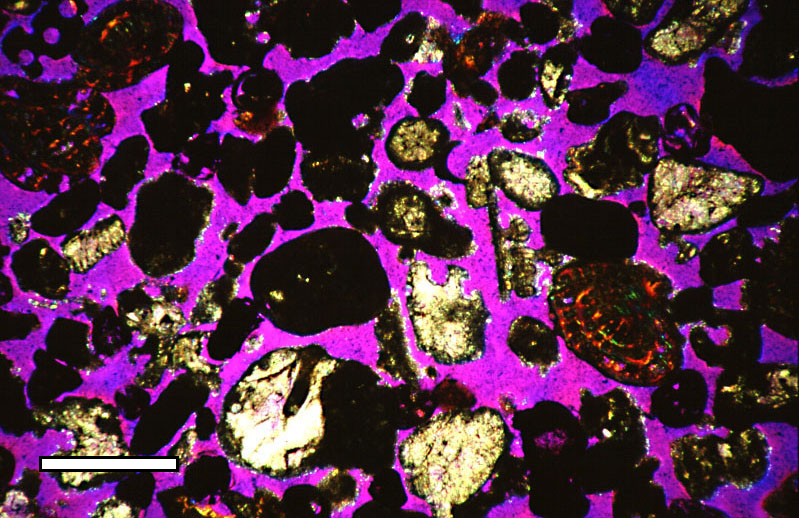
Weekly Blog 12/11 - Permeability and Porosity


https://upload.wikimedia.org/wikipedia/commons/f/ff/Porosity_thin_section_GP.jpg

Summary

There are many different types of soil. Some soil has high porosity while some has high permeability. The porosity of soil is how many pores (spaces between soil particles) there are and how big the pores are. If there are many pores, it has high porosity. If it has less pores and a larger space between each particle, the soil has low porosity. Permeability is how easily water can flow through. When something has high porosity, it has low permeability. If there are less gaps which are small, it is harder for water to go through. It also takes more time. If the soil however has low porosity, it is more permeable since water can flow through big gaps fast and easily.


S&EP 4: Analyzing and Interpreting Data

I analyzed the data when I learned about soil porosity and permeability. I had to read and analyze a small passage about permeability and porosity. After this, I interpreted the meaning of the data when I listened to as well as contributed to our class discussion about what the two are and how it can affect people like farmers, architects, and environmentalists. After I analyzed the data, I also interpreted it when I filled out a little information about what the two are. I also analyzed an interpreted data when I filled out a table about my charity fair products carbon footprint.We had to calculate the amount of CO2 emissions were being released by the transportation of my product from where it was manufactured to San Jose.

Sunday, December 6, 2015

12/6 Soil and Dirt

https://farm9.staticflickr.com/8310/8053614949_d7a02c92c5_o_d.jpg

Summary

Many people might not know this, but dirt and soil is actually one of our most important natural resources in the world. Soil is responsible for many things such as farming and agriculture, many major forests, providing us with a source of timer, fuel, and homes to many plants and animals. It is also a water filter, air cleaner, it can help create clothing (cotton plants), and can even hold toxic materials that we be around if not for soil. Franklin D. Roosevelt said "a nation that destroys soil destroys itself". So how is soil made? Soil is actually just weathered down bedrock. Once the bedrock mixes with other materials on the surface, soil is made.


S&EP 4: Analyzing and Interpreting Data

I analysed and interpreted data when I filled out a background research sheet about soil with my group. I had to research specific things such as what is soil, how soil is formed, what is the composition of soil, how soil is formed, and more. I also analyzed and interpreted data when my group was deciding about what case studies we should work on for next week. We had to read the information about the case studies and decide on which one would be most interesting.

Monday, November 16, 2015

Safest Place in America Essay

        Have you ever wondered what the safest place in America is? Well, I have an answer! Allentown, Pennsylvania. Allentown is on the east side of Pennsylvania which is on the northeast side of the United States. Also, it is the third most populous city in Pennsylvania! Allentown is the safest place in America because it is free from these three major natural disasters. Tsunamis, earthquakes, and tornadoes. Why is it you ask? Read on to find out more!


Splash! There is a tsunami! No worries, were safe in Allentown. To first understand why Allentown is safe from tsunamis, you need to know what it is, where it occurs geographically, and what conditions it forms under. Imagine this, you throw a rock into a small pond. What happens? You create ripples in the water of course! Now, imagine those ripples but 1000 x larger. That is a tsunami.

Tsunamis can be triggered by many things such as volcanic eruptions, landslides, earthquakes, and even (theoretically) asteroids and comets. However, most often tsunamis form from earthquakes at subduction zones. When 2 oceanic and continental plates collide at convergent boundaries and create subduction zones, the force is so strong that it can create tsunami waves in the ocean. Specifically, the earthquake has to be at least 7.0 on the Richter scale.

So where do they occur? Tsunamis only occur on the coast and most often occur on the west coast due to the Ring of Fire. The Ring of Fire is an area in the Pacific ocean that faces the west coast. There, lots of volcanic eruptions and earthquakes occur create tsunamis heading the direction of the west coast. Allentown is not on a coast or on the west coast. It is actually on the east side of America. Therefore, Allentown is safe from tsunamis. Here's a fun fact, did you know that tsunami is actually a Japanese word that can be translated to "harbor wave" in English?


Now to learn why Allentown is free from earthquakes. Earthquakes are when the ground shakes. They occur along plate boundaries. A convergent boundary is when two plates crash together. A divergent boundary is when two plates slide apart. Finally, a transformed boundary is when two plates slide against each other. In the U.S.A, earthquakes most often occur along the west side of the U.S.A (much like tsunamis). The west side of the U.S.A is right on the edge of the North American Plate, that means that it can hit the Pacific plate which is right beside it. When these two plates collide together, earthquakes can occur along the west coast. Allentown is again not on the west side of America or near any plate boundaries. Therefore, earthquakes cannot occur in Allentown


The final natural disaster I will be talking about is tornadoes. A tornado is a violent spiraling column of wind that descends from a thunderstorm. They can cause lots of damage. In order for a tornado to occur, they need flat land allowing the air to build up and keep spinning. Tornadoes occur most often in tornado alley, a place with very flat land. Tornado alley includes Texas, Oklahoma, and other states in that area. Pennsylvania is not in tornado alley since its land is not as flat as it needs to be. Also, in order for a tornado to form, you need a cold/dry air mass, a warm/moist air mass, falling pressure, and unsteady winds. The cold air mass comes from Canada while the warm air mass will come from the Gulf of Mexico. Even though these elements can occur in Allentown, the hills and mountains there will prevent tornadoes. That is why Allentown is free of tornadoes.


A similar article was published by the New York Times. They said that Corvallis, Oregon was the safest place in America. However, this is incorrect because of two reasons. One reason is because tsunamis can occur there because of the location of the ring of fire. As you know tsunamis occur along the west coast, where Oregon is. That is one reason why Corvallis, Oregon is not the safest place in America. The second reason why it is not the safest place is because earthquakes can occur there. Since it is again on the west coast, it is right at the boundary between the Pacific and North American Plate. This means that those two plates can collide creating earthquakes in Corvallis, Oregon. I hope you learned lots about the safest place in America... Corvallis, Oregon!

Sunday, November 15, 2015

11/15 Natural Disasters

https://encrypted-tbn2.gstatic.com/images?q=tbn:ANd9GcT04HYOvjoAj1OLtpcc3VzLKOQPPw3uAW4-XJfrPzU5HKJlVD5FyA

Summary

My group found that Allentown, Pennsylvania is pretty safe from natural disasters. For sure it is safe from sunamis. Tsunamis only occur on the west coast of the US becuase of the Ring of Fire. The Ring of Fire is located in the Pacific ocean so it faces the west coast. Allentown is safe from tsunamis because of 2 reasons. One, it is not on ANY COAST. How can a tsunami crash into the inside of the United States?!?! Second, it's not on the west coast anyway, actually its on the east side of the United States. The reason why they mainly occur around the Ring of Fire is because they are most often caused by earthquakes and lots of earthquakes happen around the ring of fire. 

S&EP 4-Analyzing and Interpreting Data

I analyzed and interpreted data when I wroe a script including all the information we need in our presentation with my group. We have to create a presentation about the safest place in america so my group decided to create a video. The video had to include 3 content pieces and a counterargument. We also analyzed and interpreted data when we looked at our map of natural disasters and decided which state and city to choose based on our research from the past week. We choose Allentown, PA.


Sunday, November 8, 2015

11/8/2015 Safest Place in America (Tornadoes)

https://upload.wikimedia.org/wikipedia/commons/thumb/4/43/Tornado_Alley_Diagram.svg/2000px-Tornado_Alley_Diagram.svg.png
https://upload.wikimedia.org/wikipedia/commons/1/1a/Dszpics1.jpg

Summary

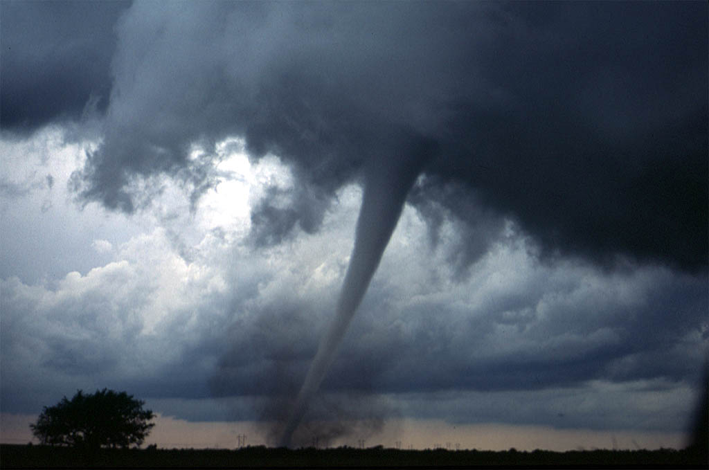
A tornado is a violently rotating column of wind that extends from a thunderstorm to the ground.  They can tear up anything in their path and can cause minimal to massive damage. The damage is measured something called the Enhanced Fujita scale (a new version on the Fujita scale in use since 2007) which goes from EF-0 (weak) to EF-5. Tornadoes occur most often (in the U.S.) in a place called tornado alley. This is because the land there is very flat and open. Tornado alley consists of places are Texas, Oklahoma, Kansas, Nebraska, and South Dakota. For them to form, you need cold/dry air, warm/moist air, falling pressure, and unsteady winds.


S&EP 4: Analyzing and Interpreting Data

I analyzed and interpreted data when I filled out worksheets on natural disasters. First, I had to write a description and define/describe the natural disaster. Then, I had to write where it is likely to occur geographically and why it occurs there. After that was finished, I had to write about the formation conditions (things like the landscape and temperatures) and write down the sources. Finally, I had to color in on a map which states the natural disaster occurs. I had to complete worksheets on wildfires, thunderstorms, hurricanes, tornadoes, blizzards, earthquakes, and tsunamis.


Sunday, November 1, 2015

10/30/15 Weekly Blog- Safest Place In America

https://c2.staticflickr.com/4/3132/2614771667_085fa5d69d_b.jpg

Summary:

A wildfire is a fire that happens in (typically) in the wild. They are large fires that burn in areas like forests and other places in nature that can be caused by many things such as lightning. However, the most common reason for wildfires is simple carelessness such as fires not fully put out. One fun fact is that California is one of the top wildfire-prone states. Another natural disaster is hurricanes which are giant swirling storms. They can spin at speeds of 75-200 mph. Hurricanes gather energy through warm ocean waters and are very dangerous once they hit land. The eye, located in the middle, is the calmest part of a hurricane.

S&EP-SP4: Analyzing and interpreting data:

We analyzed and interpreted data when we filled out worksheets about Wildfires, Hurricanes, and Thunderstorms. This is because we had to fill out information on the natural disaster such as what it is, where it occurs geographically, the formation conditions, and coloring in a map about what states do these natural disasters occur in often. We had to research, analyze, and interpreted data by gathering information on these topics in order to find the safest place in America.